Here is not a subject line you would expect to get from your local government in the U.S., “Gemeente publiceert bommenkaart.” Translation – Municipality publishes bomb map.
It is not something I thought about before, but The Netherlands was home to a number of minefields. Of course not all of these ordinances exploded. It is estimated that at one point, 10% of ordinances went unexploded. Over the years many of these have been located and removed, but there is still a risk. Further, after the war, explosives were dumped in the water as a means of “disposal.” So that means there are still potential explosives even today.
In an effort to warn people prior to excavation and construction, the town has put together a map of potential danger areas. The map was first prepared in 2018 and updated again in 2022. In areas where there has been significant construction since the war, most ordinances have been located, but still, it is required that investigations are done any time digging more than 30 cm (12 in) is planned in these Expected Areas.
One of the key danger spots is near our much loved beach. There was fighting in the dune area and bombs and grenades have been found here. In addition, aircraft bombed the area, so those ordinances could be found as well but buried a few meters.
Here is a map that includes our house and our daughter’s school. While our house isn’t in an Expected Area, her school is. You can find the full map here.
 | 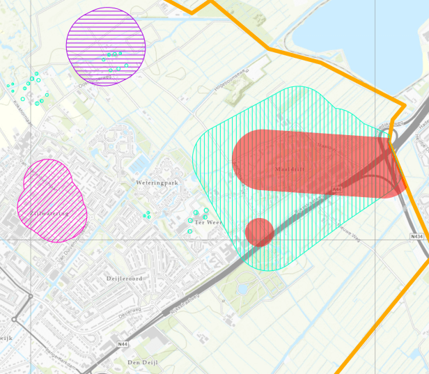 |
| Locations the beach | Locations near our house and the school |